Upcoming Event
 Free Newsletter


The futurist: Agriculture’s game of drones
Thomas Frey //August 30, 2013//


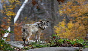
The residents of Deer Trail recently made national news with a proposed ballot initiative to allow hunting licenses to shoot down flying drones.
Deer Trail would charge $25 for drone hunting licenses, and the town would offer a $100 bounty reward for shooters who bring in debris from an unmanned aircraft from the U.S. government.
This perfectly illustrates the growing paranoia associated with UAVs (Unmanned Aerial Vehicles), often referred to as drones.
But the good people living in the farming community of Deer Trail have obviously not been paying attention to the positive uses for drones, more specifically, the use of drones in agriculture.
Even though the vast majority of drone use today is government and military, one of the big emerging markets will be agriculture. Several new companies have begun moving into the ag-drone space, but there are a few short-term problems.
Current FAA rules limit their operation to under 400 feet and to steer clear of airports and crowds on the ground. But that will change in a couple years. The U.S. Congress has mandated the FAA incorporate drones into national airspace by Sept. 30, 2015.
Many in this new industry are chomping at the bit to get started. According to the Association for Unmanned Vehicles International, once drones get okayed for the national air space, the first three years will produce $13.6 billion in economic activity, and 34,000 new manufacturing jobs will get created.
The FAA estimated up to 10,000 drones could be airborne in the U.S. by 2018. Here’s why that number is far too low.
Today’s Ag Industry Drones
There are many possible uses for flying drones, and as we add capabilities, potential uses will grow dramatically.
We are limited in our thinking to what we see today, but flying drones can be built large enough to move people and houses, and small enough to be invisible to the human eye.
They provide an incredibly flexible platform, and simply adding elements like cameras, lights, audio, sensors, video projectors, or even a robotic arm can increase the utility of a drone exponentially. I’ve written about some of these possibilities in previous articles.
The automation of farming has led to fewer people tending massive estates, with many growing to tens of thousands of acres. This means there are fewer eyes inspecting crops, with less chance of catching problems like disease, infestations, soil issues, or other deficiencies.
Drones, however, have the ability to amp up awareness, giving farmers powerful tools for managing both the plant and its growing environment throughout its lifecycle.
Here are a few current examples of the type of inspections and research that can be automated through the use of drones:
- Terrain, rock, tree, and obstacle mapping
- Hybrid lifecycle charting
- Chlorophyll damage detection
- Ground cover profiling
- Wind profile and wind shear assessment
- Temperature and barometric pressure profiling
- Spore, dust, pollen counts
- Water quality assessments and survey
- Methane, ammonia, and CO2 sensing
- Trait assessment for breeding
- Wireless data collection from ground sensors
- Plant status tracking
- Crop status (growing stage, yield estimates, etc.)
- Precision Agriculture prescription data
- Tiling/drainage evaluation and survey
- Time-saving pre-assessment for field tasks
- Oblique shots for de-tassel timing
- Drainage estimates and topography
- Planting evaluation and replanting requirements
- Pathogen introduction and tracking + Weed levels
Drone Startups
With military use of drones beginning to level off, the industry itself is searching for other options, and agriculture seems to be at the top of everyone’s list.
Startups in this area require a rare blend of skills. In addition to the obvious skills of aviation and agriculture, they need people skilled in wireless communications, image sensors, illumination sciences, photonics, optoelectronics, photoreceptors, spatial imaging, lens mounting hardware, and much more.
Here are a few of the cutting edge companies entering this field:
1) Landcaster Hawkeye Mark III from PrecisionHawk (precisionhawk.com)
Completely autonomous, fixed-wing system, weighing 3 lbs., can survey 300 acres in a 40-min. flight and allows for high-resolution imagery and video.
2) LP960 from Lehmann Aviation (LehmannAviation.com)
The LP960 is able to detect damaged crops by taking aerial images with a thermal camera and can be flown in harsh environments, between -13 degrees F up to 140 degrees. The system can monitor moisture levels and damage from pests or disease. Cost is $9,300.
3) The Octane from Volt Aerial Robotics (voltaerialrobotics.com)
The Octane multirotor drone weighs 4 lbs. and takes high resolution, GPS-referenced imagery and video, and the company claims is easier to fly than fixed-wing UAVs. Cost is $3,800.
4) eBee and SwingletCAM by senseFly (sensefly.com)
SenseFly, a Switzerland-based manufacturer of both the eBee UAV and the Swinglet CAM, is already selling its digital camera equipped mini-drones to growers and retailers in Canada. Using fully photogrammetric software, these drones can create high-resolution Orthomosaic reconstructions from aerial imagery. 16 megapixel camera and 30 minutes flight range.
5) AIMQ by DMZ Aerial (dmzaerial.com)
DMZ Aerial’s Aerial Intelligence Modified Quadcopter, is sold in a package, which includes the UAV, the iPad flight app, camera, charging station, high performance batteries, Wi-Fi extender, and a tracking system. The UAV is controlled manually by using an iPad. DMZ provides flight training, guidance on effective scouting and technical support. Cost is $2,900 for the entire system.
6) The Multirotor by Aerial Precision Ag (aparotor.com)
The Multirotor ready to fly kit comes with the system fully assembled, along with a stabilized GoPro3 camera, radio controller, batteries/charger, and a waterproof case. APA’s newest model, the fully autonomous APA X4 is priced at $5,000.
7) Experimental Ag Drone by InventWorks (inventworksinc.com)
InventWorks, Inc. and Boulder Labs Inc. have collaborated on developing an autonomous aerial drone with multispectral cameras to capture high-resolution images of row crop. Image identification software will give farmers precise location of weeds that require suppression.
8) RMAX by Yamaha (rmax.yamaha-motor.com.au)
Yamaha’s development of utility-use unmanned helicopters began with a request in 1983 from the external branch of the Japanese Ministry of Agriculture, Forestry and Fisheries, which was also in charge of agricultural aviation. They wanted an unmanned helicopter for crop dusting that could help reduce labor and costs in Japan’s labor-strapped rice farming industry. Depending on how it’s equipped, costs can range from $150,000 to $230,000.
(More on Tuesday.)